


Jausiers Lac des Sagnes

Eric2208
User
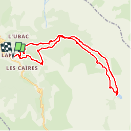

Length
21 km

Max alt
2038 m

Uphill gradient
673 m
Km-Effort
30 km

Min alt
1513 m

Downhill gradient
673 m
Boucle
Yes
Creation date :
2019-10-27 07:58:20.46
Updated on :
2019-10-28 06:53:40.31
6h44
Difficulty : Very easy

FREE GPS app for hiking
 SityTrail
IGN / Geographical institutes
SityTrail Plus
The world is yours!
About
Trail Walking of 21 km to be discovered at Provence-Alpes-Côte d'Azur, Alpes-de-Haute-Provence, Jausiers. This trail is proposed by Eric2208.
Positioning
Country:
France
Region :
Provence-Alpes-Côte d'Azur
Department/Province :
Alpes-de-Haute-Provence
Municipality :
Jausiers
Location:
Unknown
Start:(Dec)
Start:(UTM)
321768 ; 4919207 (32T) N.
Comments