


Durbuy

cmar
User

Length
46 km

Max alt
310 m

Uphill gradient
1451 m
Km-Effort
65 km

Min alt
57 m

Downhill gradient
1289 m
Boucle
No
Creation date :
2019-10-27 11:44:00.0
Updated on :
2019-10-29 16:03:22.707
1h50
Difficulty : Unknown

FREE GPS app for hiking
 SityTrail
IGN / Geographical institutes
SityTrail Plus
The world is yours!
About
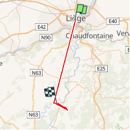
Trail Walking of 46 km to be discovered at Wallonia, Liège, Liège. This trail is proposed by cmar.
Positioning
Country:
Belgium
Region :
Wallonia
Department/Province :
Liège
Municipality :
Liège
Location:
Grivegnée
Start:(Dec)
Start:(UTM)
681715 ; 5612574 (31U) N.
Comments