


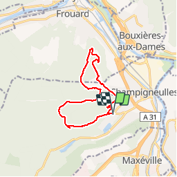
champigneulles batterie de l'éperon

inesmyt
User

Length
11.2 km

Max alt
356 m

Uphill gradient
245 m
Km-Effort
14.5 km

Min alt
227 m

Downhill gradient
246 m
Boucle
Yes
Creation date :
2019-11-01 09:11:45.658
Updated on :
2019-11-01 11:48:03.684
2h29
Difficulty : Very easy

FREE GPS app for hiking
 SityTrail
IGN / Geographical institutes
SityTrail Plus
The world is yours!
About
Trail Walking of 11.2 km to be discovered at Grand Est, Meurthe-et-Moselle, Champigneulles. This trail is proposed by inesmyt.
Positioning
Country:
France
Region :
Grand Est
Department/Province :
Meurthe-et-Moselle
Municipality :
Champigneulles
Location:
Unknown
Start:(Dec)
Start:(UTM)
290395 ; 5401030 (32U) N.
Comments