


Trajet

coglais
User

Length
9.8 km

Max alt
1913 m

Uphill gradient
684 m
Km-Effort
18.9 km

Min alt
1261 m

Downhill gradient
685 m
Boucle
Yes
Creation date :
2019-11-03 16:01:35.521
Updated on :
2022-04-10 10:41:42.53
3h00
Difficulty : Difficult

FREE GPS app for hiking
 SityTrail
IGN / Geographical institutes
SityTrail Plus
The world is yours!
About
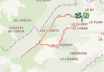
Trail Nordic walking of 9.8 km to be discovered at Auvergne-Rhône-Alpes, Upper Savoy, Cordon. This trail is proposed by coglais.


Positioning
Country:
France
Region :
Auvergne-Rhône-Alpes
Department/Province :
Upper Savoy
Municipality :
Cordon
Location:
Unknown
Start:(Dec)
Start:(UTM)
313245 ; 5088261 (32T) N.
Comments