Highland SityTrail > Trails > Outdoor > United Kingdom > Scotland > Argyll and Bute > Arrochar SityTrail > Trails > Outdoor > United Kingdom > Scotland > Argyll and Bute > Arrochar Highland francis.bourgeoi@gmail.com User 3D © OpenStreetMap contributors Length 15.9 km Max alt 632 m Uphill gradient 773 m Km-Effort 26 km Min alt 1 m Downhill gradient 820 m Boucle No Creation date : 2019-11-03 11:25:01.105 Updated on : 2019-11-03 16:52:25.041 (0 Reviews) Walking 5h26 Difficulty : Very easy FREE GPS app for hiking SityTrail IGN / Geographical institutes SityTrail World The world is yours! About 
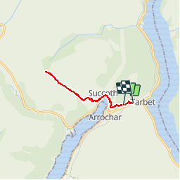
Trail Walking of 15.9 km to be discovered at Scotland, Argyll and Bute. This trail is proposed by francis.bourgeoi@gmail.com. Legends | More details (PDF) Elevation profile Legends > 15% 15% - 10% 10% - 5% flat 5% - 10% 10% - 15% 15% - 30% > 30% Positioning Country: United Kingdom Region : Scotland Department/Province : Argyll and Bute Municipality : Arrochar Location: Unknown Start:(Dec) 56.2020363 / -4.73042839 Start:(UTM) 392647 ; 6229913 (30V) N. Comments Please log in to post a review or rate the element Trails nearby Airelle 2023 Ecosse J03 Walking Very difficult , Scotland, Stirling, United Kingdom 29 km | 37 km-effort 8h 30min No