


montlambert

whisper73
User
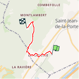

Length
3.6 km

Max alt
888 m

Uphill gradient
611 m
Km-Effort
9.7 km

Min alt
273 m

Downhill gradient
0 m
Boucle
No
Creation date :
2014-12-10 00:00:00.0
Updated on :
2014-12-10 00:00:00.0
1h05
Difficulty : Very easy

FREE GPS app for hiking
 SityTrail
IGN / Geographical institutes
SityTrail Plus
The world is yours!
About
Trail Walking of 3.6 km to be discovered at Auvergne-Rhône-Alpes, Savoy, Saint-Jean-de-la-Porte. This trail is proposed by whisper73.
Description
depuis atterro
Positioning
Country:
France
Region :
Auvergne-Rhône-Alpes
Department/Province :
Savoy
Municipality :
Saint-Jean-de-la-Porte
Location:
Unknown
Start:(Dec)
Start:(UTM)
275057 ; 5047258 (32T) N.
Comments