


20191105-Les Essarts COOL

doudet
User
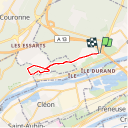

Length
8.5 km

Max alt
140 m

Uphill gradient
137 m
Km-Effort
10.4 km

Min alt
38 m

Downhill gradient
137 m
Boucle
Yes
Creation date :
2019-11-05 08:36:17.931
Updated on :
2019-11-06 07:54:17.754
2h15
Difficulty : Easy

FREE GPS app for hiking
 SityTrail
IGN / Geographical institutes
SityTrail Plus
The world is yours!
About
Trail Walking of 8.5 km to be discovered at Normandy, Seine-Maritime, Oissel. This trail is proposed by doudet.
Description
Boucle A-R au départ du Pont de l'Autoroute de Oissel ( Près du château Lerminier)
Positioning
Country:
France
Region :
Normandy
Department/Province :
Seine-Maritime
Municipality :
Oissel
Location:
Unknown
Start:(Dec)
Start:(UTM)
359809 ; 5466724 (31U) N.
Comments