


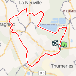
Thumeries - Wahagnies- La Neuville - Beaujolais nouveau

dehemjacques
User

Length
9.1 km

Max alt
65 m

Uphill gradient
63 m
Km-Effort
10 km

Min alt
45 m

Downhill gradient
63 m
Boucle
Yes
Creation date :
2019-11-06 16:27:24.242
Updated on :
2019-11-06 16:28:37.622
1h50
Difficulty : Very easy

FREE GPS app for hiking
 SityTrail
IGN / Geographical institutes
SityTrail Plus
The world is yours!
About
Trail On foot of 9.1 km to be discovered at Hauts-de-France, Nord, Thumeries. This trail is proposed by dehemjacques.
Description
la rando du Beaujolais Nouveau
Positioning
Country:
France
Region :
Hauts-de-France
Department/Province :
Nord
Municipality :
Thumeries
Location:
Unknown
Start:(Dec)
Start:(UTM)
504627 ; 5591782 (31U) N.
Comments