


Crest

raygautier
User
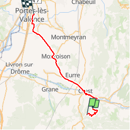

Length
39 km

Max alt
368 m

Uphill gradient
463 m
Km-Effort
46 km

Min alt
108 m

Downhill gradient
705 m
Boucle
No
Creation date :
2019-11-07 09:16:48.0
Updated on :
2019-11-08 15:33:14.798
30h12
Difficulty : Unknown

FREE GPS app for hiking
 SityTrail
IGN / Geographical institutes
SityTrail Plus
The world is yours!
About
Trail Walking of 39 km to be discovered at Auvergne-Rhône-Alpes, Drôme, Divajeu. This trail is proposed by raygautier.
Positioning
Country:
France
Region :
Auvergne-Rhône-Alpes
Department/Province :
Drôme
Municipality :
Divajeu
Location:
Unknown
Start:(Dec)
Start:(UTM)
660669 ; 4949710 (31T) N.
Comments