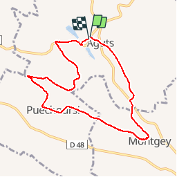
Aguts boucle du calvaire à Montgey

tabouelle
User

Length
8.9 km

Max alt
320 m

Uphill gradient
159 m
Km-Effort
11 km

Min alt
252 m

Downhill gradient
162 m
Boucle
Yes
Creation date :
2019-10-24 07:11:12.899
Updated on :
2019-11-09 14:17:20.181
2h46
Difficulty : Easy

FREE GPS app for hiking
 SityTrail
IGN / Geographical institutes
SityTrail Plus
The world is yours!
About
Trail Walking of 8.9 km to be discovered at Occitania, Tarn, Aguts. This trail is proposed by tabouelle.
Description
8,9 km
Positioning
Country:
France
Region :
Occitania
Department/Province :
Tarn
Municipality :
Aguts
Location:
Unknown
Start:(Dec)
Start:(UTM)
412653 ; 4820271 (31T) N.
Comments