


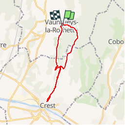
Vaunaveys la Rochette A/R - 12 km

okfred26
User

Length
12 km

Max alt
412 m

Uphill gradient
392 m
Km-Effort
17.2 km

Min alt
251 m

Downhill gradient
392 m
Boucle
Yes
Creation date :
2019-11-11 19:56:57.673
Updated on :
2019-11-11 20:04:00.836
3h36
Difficulty : Difficult

FREE GPS app for hiking
 SityTrail
IGN / Geographical institutes
SityTrail Plus
The world is yours!
About
Trail Walking of 12 km to be discovered at Auvergne-Rhône-Alpes, Drôme, Vaunaveys-la-Rochette. This trail is proposed by okfred26.
Positioning
Country:
France
Region :
Auvergne-Rhône-Alpes
Department/Province :
Drôme
Municipality :
Vaunaveys-la-Rochette
Location:
Unknown
Start:(Dec)
Start:(UTM)
660975 ; 4959167 (31T) N.
Comments