


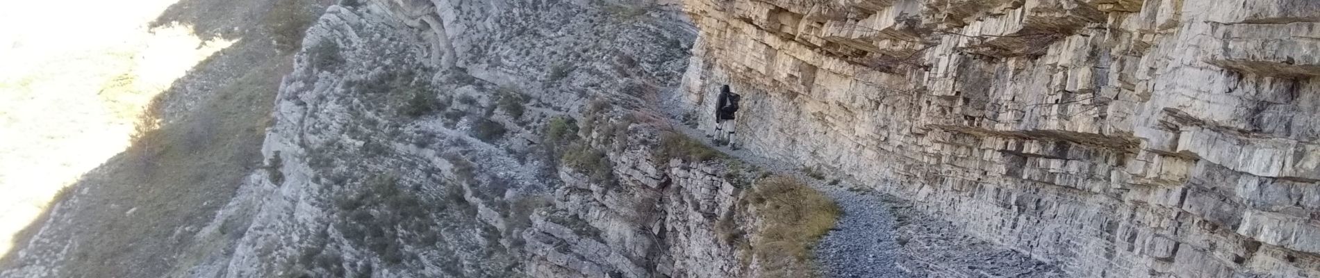
gorge du petit Buëch

nadd73
User GUIDE
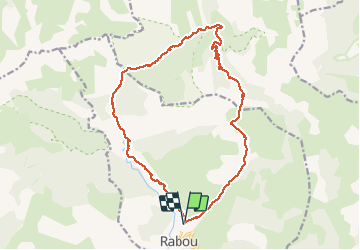

Length
18.9 km

Max alt
1673 m

Uphill gradient
779 m
Km-Effort
29 km

Min alt
1137 m

Downhill gradient
777 m
Boucle
Yes
Creation date :
2019-11-13 08:23:23.498
Updated on :
2019-11-15 07:57:06.217
6h23
Difficulty : Difficult

FREE GPS app for hiking
 SityTrail
IGN / Geographical institutes
SityTrail Plus
The world is yours!
About
Trail Walking of 18.9 km to be discovered at Provence-Alpes-Côte d'Azur, Hautes-Alpes, Rabou. This trail is proposed by nadd73.
Description
départ au dessus de Rabou. suivre le GR passer dans les gorges Chaudin. col de Chabanotte descente sur tournillon . randonnée longue
Photos


Positioning
Country:
France
Region :
Provence-Alpes-Côte d'Azur
Department/Province :
Hautes-Alpes
Municipality :
Rabou
Location:
Unknown
Start:(Dec)
Start:(UTM)
262449 ; 4942276 (32T) N.
Comments