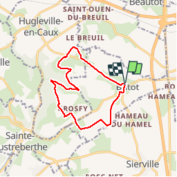
BUTOT

PHIL76750
User

Length
11.6 km

Max alt
175 m

Uphill gradient
129 m
Km-Effort
13.3 km

Min alt
131 m

Downhill gradient
128 m
Boucle
Yes
Creation date :
2019-11-17 07:55:12.213
Updated on :
2019-11-17 11:11:02.689
3h14
Difficulty : Very easy

FREE GPS app for hiking
 SityTrail
IGN / Geographical institutes
SityTrail Plus
The world is yours!
About
Trail Walking of 11.6 km to be discovered at Normandy, Seine-Maritime, Butot. This trail is proposed by PHIL76750.
Positioning
Country:
France
Region :
Normandy
Department/Province :
Seine-Maritime
Municipality :
Butot
Location:
Unknown
Start:(Dec)
Start:(UTM)
357510 ; 5497764 (31U) N.
Comments