


la montagne de la serre à Chadrat

jeanic63
User
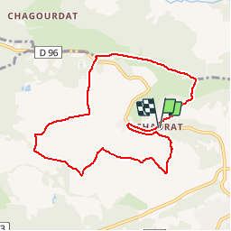

Length
8.9 km

Max alt
735 m

Uphill gradient
227 m
Km-Effort
12 km

Min alt
595 m

Downhill gradient
229 m
Boucle
Yes
Creation date :
2019-11-19 17:27:51.651
Updated on :
2019-11-19 17:31:18.755
--
Difficulty : Medium

FREE GPS app for hiking
 SityTrail
IGN / Geographical institutes
SityTrail Plus
The world is yours!
About
Trail On foot of 8.9 km to be discovered at Auvergne-Rhône-Alpes, Puy-de-Dôme, Saint-Saturnin. This trail is proposed by jeanic63.
Description
départ parking centre de chadrat
Positioning
Country:
France
Region :
Auvergne-Rhône-Alpes
Department/Province :
Puy-de-Dôme
Municipality :
Saint-Saturnin
Location:
Unknown
Start:(Dec)
Start:(UTM)
506391 ; 5057883 (31T) N.
Comments