


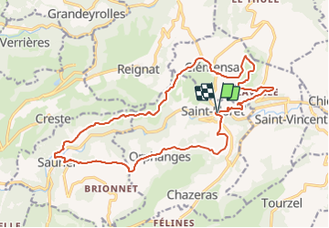
saint floret _saurier_21km

jeanic63
User

Length
21 km

Max alt
771 m

Uphill gradient
661 m
Km-Effort
30 km

Min alt
493 m

Downhill gradient
665 m
Boucle
Yes
Creation date :
2019-11-20 17:56:45.592
Updated on :
2021-07-20 17:00:38.683
--
Difficulty : Difficult

FREE GPS app for hiking
 SityTrail
IGN / Geographical institutes
SityTrail Plus
The world is yours!
About
Trail On foot of 21 km to be discovered at Auvergne-Rhône-Alpes, Puy-de-Dôme, Saint-Floret. This trail is proposed by jeanic63.
Description
départ de saint floret
Positioning
Country:
France
Region :
Auvergne-Rhône-Alpes
Department/Province :
Puy-de-Dôme
Municipality :
Saint-Floret
Location:
Unknown
Start:(Dec)
Start:(UTM)
508313 ; 5044171 (31T) N.
Comments