


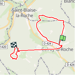
Rando Voges Coleroy la Roche

TRIMAILLE
User

Length
8.5 km

Max alt
659 m

Uphill gradient
342 m
Km-Effort
12.9 km

Min alt
453 m

Downhill gradient
282 m
Boucle
No
Creation date :
2019-11-24 22:13:56.998
Updated on :
2019-11-27 16:35:38.702
2h42
Difficulty : Easy

FREE GPS app for hiking
 SityTrail
IGN / Geographical institutes
SityTrail Plus
The world is yours!
About
Trail Walking of 8.5 km to be discovered at Grand Est, Bas-Rhin, Colroy-la-Roche. This trail is proposed by TRIMAILLE.
Positioning
Country:
France
Region :
Grand Est
Department/Province :
Bas-Rhin
Municipality :
Colroy-la-Roche
Location:
Unknown
Start:(Dec)
Start:(UTM)
365419 ; 5361394 (32U) N.
Comments