


Rando Chamaloc

TRIMAILLE
User
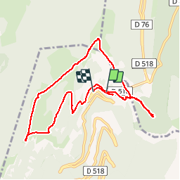

Length
10 km

Max alt
1641 m

Uphill gradient
554 m
Km-Effort
17.4 km

Min alt
1228 m

Downhill gradient
568 m
Boucle
No
Creation date :
2019-11-25 11:06:51.375
Updated on :
2019-11-27 10:52:32.364
3h31
Difficulty : Medium

FREE GPS app for hiking
 SityTrail
IGN / Geographical institutes
SityTrail Plus
The world is yours!
About
Trail Walking of 10 km to be discovered at Auvergne-Rhône-Alpes, Drôme, Chamaloc. This trail is proposed by TRIMAILLE.
Positioning
Country:
France
Region :
Auvergne-Rhône-Alpes
Department/Province :
Drôme
Municipality :
Chamaloc
Location:
Unknown
Start:(Dec)
Start:(UTM)
689348 ; 4967807 (31T) N.
Comments