


Rando Caurel

TRIMAILLE
User
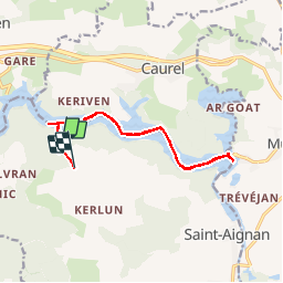

Length
13.2 km

Max alt
210 m

Uphill gradient
96 m
Km-Effort
14.3 km

Min alt
121 m

Downhill gradient
47 m
Boucle
No
Creation date :
2019-11-25 11:25:14.967
Updated on :
2019-11-25 18:18:52.974
3h12
Difficulty : Difficult

FREE GPS app for hiking
 SityTrail
IGN / Geographical institutes
SityTrail Plus
The world is yours!
About
Trail Walking of 13.2 km to be discovered at Brittany, Morbihan, Saint-Aignan. This trail is proposed by TRIMAILLE.
Description
Attention ce circuit ne peux se faire que lorsque le barrage est en travaux et la rivière vidée.
Alors guettez les prochains travaux car s'est extraordinaire.
Positioning
Country:
France
Region :
Brittany
Department/Province :
Morbihan
Municipality :
Saint-Aignan
Location:
Unknown
Start:(Dec)
Start:(UTM)
494944 ; 5338421 (30U) N.
Comments