


Rando Chamonix Mont Blanc

TRIMAILLE
User
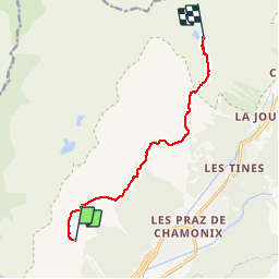

Length
9.1 km

Max alt
2363 m

Uphill gradient
684 m
Km-Effort
17.2 km

Min alt
1810 m

Downhill gradient
366 m
Boucle
No
Creation date :
2019-11-25 11:34:30.267
Updated on :
2019-11-25 18:12:48.585
3h37
Difficulty : Difficult

FREE GPS app for hiking
 SityTrail
IGN / Geographical institutes
SityTrail Plus
The world is yours!
About
Trail Walking of 9.1 km to be discovered at Auvergne-Rhône-Alpes, Upper Savoy, Chamonix-Mont-Blanc. This trail is proposed by TRIMAILLE.
Positioning
Country:
France
Region :
Auvergne-Rhône-Alpes
Department/Province :
Upper Savoy
Municipality :
Chamonix-Mont-Blanc
Location:
Unknown
Start:(Dec)
Start:(UTM)
333423 ; 5089314 (32T) N.
Comments