


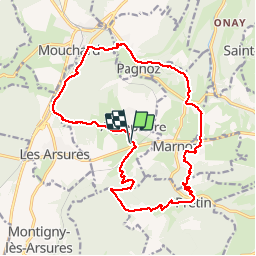
Rando Aiglepierre

TRIMAILLE
User

Length
18.6 km

Max alt
558 m

Uphill gradient
771 m
Km-Effort
29 km

Min alt
283 m

Downhill gradient
772 m
Boucle
Yes
Creation date :
2019-11-25 16:38:22.054
Updated on :
2019-11-27 10:08:22.387
5h58
Difficulty : Very difficult

FREE GPS app for hiking
 SityTrail
IGN / Geographical institutes
SityTrail Plus
The world is yours!
About
Trail Walking of 18.6 km to be discovered at Bourgogne-Franche-Comté, Jura, Aiglepierre. This trail is proposed by TRIMAILLE.
Positioning
Country:
France
Region :
Bourgogne-Franche-Comté
Department/Province :
Jura
Municipality :
Aiglepierre
Location:
Unknown
Start:(Dec)
Start:(UTM)
714358 ; 5203425 (31T) N.
Comments