


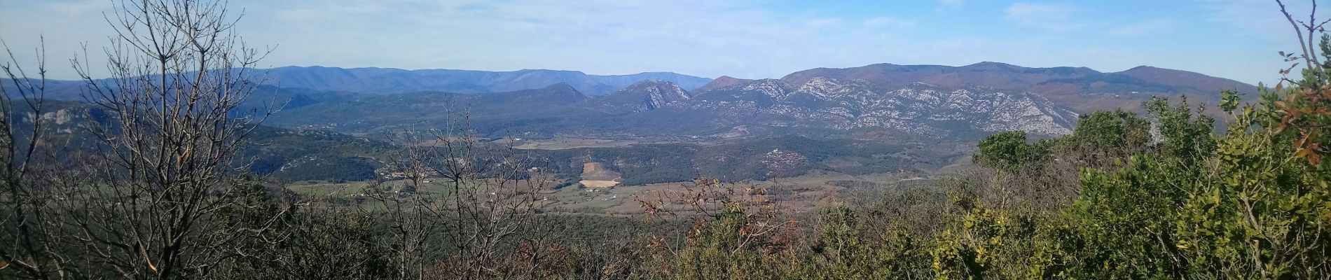
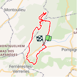
Arsel entre Pompignane et ferrieres les verreries

labarone
User

Length
15.4 km

Max alt
520 m

Uphill gradient
538 m
Km-Effort
23 km

Min alt
200 m

Downhill gradient
534 m
Boucle
Yes
Creation date :
2019-11-26 07:50:52.034
Updated on :
2019-11-26 14:28:08.188
6h08
Difficulty : Easy

FREE GPS app for hiking
 SityTrail
IGN / Geographical institutes
SityTrail Plus
The world is yours!
About
Trail Walking of 15.4 km to be discovered at Occitania, Gard, Pompignan. This trail is proposed by labarone.
Photos


Positioning
Country:
France
Region :
Occitania
Department/Province :
Gard
Municipality :
Pompignan
Location:
Unknown
Start:(Dec)
Start:(UTM)
566219 ; 4860820 (31T) N.
Comments