


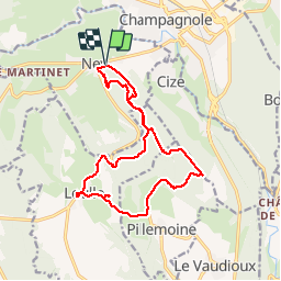
Rando Ney

TRIMAILLE
User

Length
15.7 km

Max alt
800 m

Uphill gradient
417 m
Km-Effort
21 km

Min alt
535 m

Downhill gradient
419 m
Boucle
Yes
Creation date :
2019-11-27 17:45:56.377
Updated on :
2019-11-27 17:46:50.826
4h31
Difficulty : Medium

FREE GPS app for hiking
 SityTrail
IGN / Geographical institutes
SityTrail Plus
The world is yours!
About
Trail Walking of 15.7 km to be discovered at Bourgogne-Franche-Comté, Jura, Ney. This trail is proposed by TRIMAILLE.
Positioning
Country:
France
Region :
Bourgogne-Franche-Comté
Department/Province :
Jura
Municipality :
Ney
Location:
Unknown
Start:(Dec)
Start:(UTM)
720758 ; 5179841 (31T) N.
Comments