


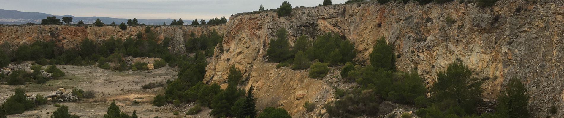
La Clape - Trou de la Crouzade

PiloudeBamako
User
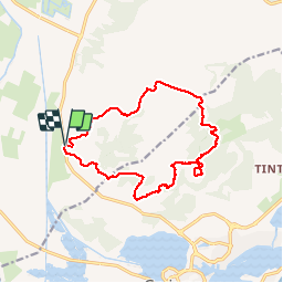

Length
15.5 km

Max alt
200 m

Uphill gradient
434 m
Km-Effort
21 km

Min alt
5 m

Downhill gradient
433 m
Boucle
Yes
Creation date :
2019-12-05 08:29:52.0
Updated on :
2019-12-09 08:50:40.837
4h30
Difficulty : Difficult

FREE GPS app for hiking
 SityTrail
IGN / Geographical institutes
SityTrail Plus
The world is yours!
About
Trail Walking of 15.5 km to be discovered at Occitania, Aude, Narbonne. This trail is proposed by PiloudeBamako.
Description
Boucle dans la Clape permettant d'observer le Trou de la Crouzade. Beaux points de vue sur la mer.
Photos


Positioning
Country:
France
Region :
Occitania
Department/Province :
Aude
Municipality :
Narbonne
Location:
Unknown
Start:(Dec)
Start:(UTM)
504285 ; 4776016 (31T) N.
Comments
