


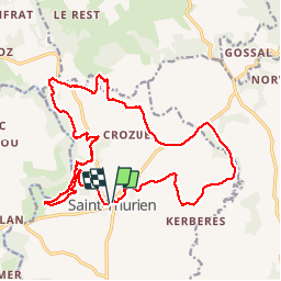

8.4 km | 10 km-effort


User


FREE GPS app for hiking
 SityTrail
IGN / Geographical institutes
SityTrail World
The world is yours!
Trail Walking of 19.9 km to be discovered at Brittany, Finistère, Saint-Thurien. This trail is proposed by RonanDAGORN.
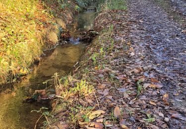
bonjour, quel plaisir de parcourir ce bocage aux couleurs autonnales par des sentiers, des chemins creux et quelques portions de route. Des moulinset la chapelle St Éloi agrémentent ce parcours. Merci.