


la Chapelle de Mougnès

CANON2
User

Length
6.4 km

Max alt
432 m

Uphill gradient
188 m
Km-Effort
8.9 km

Min alt
270 m

Downhill gradient
189 m
Boucle
Yes
Creation date :
2019-12-09 16:42:25.739
Updated on :
2019-12-09 16:44:05.872
--
Difficulty : Very easy

FREE GPS app for hiking
 SityTrail
IGN / Geographical institutes
SityTrail Plus
The world is yours!
About
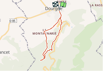
Trail On foot of 6.4 km to be discovered at Occitania, Tarn, Dourgne. This trail is proposed by CANON2.
Positioning
Country:
France
Region :
Occitania
Department/Province :
Tarn
Municipality :
Dourgne
Location:
Unknown
Start:(Dec)
Start:(UTM)
430429 ; 4814976 (31T) N.
Comments