


Roppeviller rando Bitche

TRIMAILLE
User
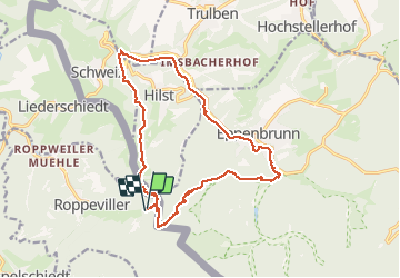

Length
18.7 km

Max alt
402 m

Uphill gradient
405 m
Km-Effort
24 km

Min alt
270 m

Downhill gradient
406 m
Boucle
Yes
Creation date :
2019-12-14 18:25:25.355
Updated on :
2019-12-14 18:28:36.396
5h09
Difficulty : Difficult

FREE GPS app for hiking
 SityTrail
IGN / Geographical institutes
SityTrail Plus
The world is yours!
About
Trail Walking of 18.7 km to be discovered at Grand Est, Moselle, Roppeviller. This trail is proposed by TRIMAILLE.
Positioning
Country:
France
Region :
Grand Est
Department/Province :
Moselle
Municipality :
Roppeviller
Location:
Unknown
Start:(Dec)
Start:(UTM)
392372 ; 5439716 (32U) N.
Comments