


le pont du diable signes par raymond

Coryphene
User
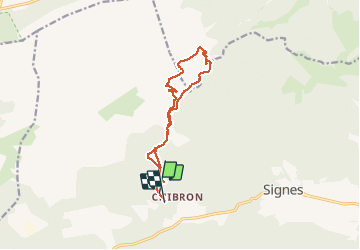

Length
12.8 km

Max alt
665 m

Uphill gradient
264 m
Km-Effort
16.4 km

Min alt
429 m

Downhill gradient
287 m
Boucle
No
Creation date :
2019-12-15 08:56:32.685
Updated on :
2019-12-15 15:05:33.848
6h07
Difficulty : Very easy

FREE GPS app for hiking
 SityTrail
IGN / Geographical institutes
SityTrail Plus
The world is yours!
About
Trail Walking of 12.8 km to be discovered at Provence-Alpes-Côte d'Azur, Var, Signes. This trail is proposed by Coryphene.
Positioning
Country:
France
Region :
Provence-Alpes-Côte d'Azur
Department/Province :
Var
Municipality :
Signes
Location:
Unknown
Start:(Dec)
Start:(UTM)
728876 ; 4796888 (31T) N.
Comments