


Olne-Soiron-Vaux

berlan2
User
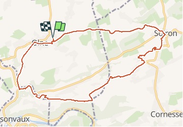

Length
10.4 km

Max alt
273 m

Uphill gradient
255 m
Km-Effort
13.8 km

Min alt
123 m

Downhill gradient
256 m
Boucle
Yes
Creation date :
2019-12-19 11:08:00.467
Updated on :
2019-12-29 18:33:00.494
2h48
Difficulty : Very easy

FREE GPS app for hiking
 SityTrail
IGN / Geographical institutes
SityTrail Plus
The world is yours!
About
Trail Walking of 10.4 km to be discovered at Wallonia, Liège, Olne. This trail is proposed by berlan2.
Positioning
Country:
Belgium
Region :
Wallonia
Department/Province :
Liège
Municipality :
Olne
Location:
Olne
Start:(Dec)
Start:(UTM)
694820 ; 5607966 (31U) N.
Comments