


st pons par Christian

Coryphene
User
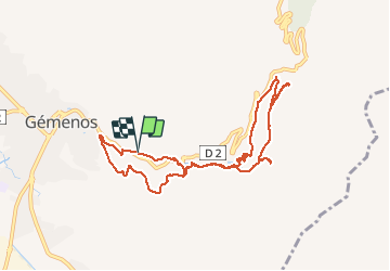

Length
10 km

Max alt
364 m

Uphill gradient
285 m
Km-Effort
13.8 km

Min alt
175 m

Downhill gradient
285 m
Boucle
Yes
Creation date :
2019-12-19 08:55:03.35
Updated on :
2020-01-06 07:13:29.904
4h49
Difficulty : Very easy

FREE GPS app for hiking
 SityTrail
IGN / Geographical institutes
SityTrail Plus
The world is yours!
About
Trail Walking of 10 km to be discovered at Provence-Alpes-Côte d'Azur, Bouches-du-Rhône, Gémenos. This trail is proposed by Coryphene.
Positioning
Country:
France
Region :
Provence-Alpes-Côte d'Azur
Department/Province :
Bouches-du-Rhône
Municipality :
Gémenos
Location:
Unknown
Start:(Dec)
Start:(UTM)
714317 ; 4796701 (31T) N.
Comments