Trail Walking Souleuvre-en-Bocage - La vire - Photo
 albers
albers

User

© OpenStreetMap contributors
Length
Length
22 km
Max alt
Max alt
176 m
Uphill gradient
Uphill gradient
478 m
Km-Effort
Km-Effort  
28 km
Min alt
Min alt
59 m
Downhill gradient
Downhill gradient
472 m
Boucle
Boucle
Yes
Creation date :
2014-12-10 00:00:00.0
Updated on :
2014-12-10 00:00:00.0

(0 Reviews)

Walking
Walking
5h00
Difficulty : Medium

Scan this QR Code to open this trail in the SityTrail application

FREE GPS app for hiking

Logo SityTrail SityTrail

IGN / Geographical institutes

Download SityTrail from the App Store Download SityTrail from Google Play

Logo SityTrail SityTrail Plus

The world is yours!

Download SityTrail from the App Store Download SityTrail from Google Play Download SityTrail on Huawei AppGallery

About

Trail Walking of 22 km to be discovered at Normandy, Calvados, Souleuvre-en-Bocage. This trail is proposed by albers.

Description

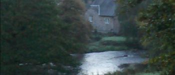
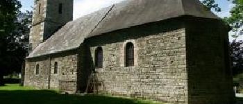
Belle randonnée dans la vallée de la vire.super petit chemin.
le temps affiché est vraiment celui ce que j'ai fait, 5 heure.
départ à 7h15 de campeaux (frontale oblige pendant une bonne heure)
"a vous de jouer".

Elevation profile

Photos

Points of interest

Point of interest Souleuvre-en-Bocage - le moulin l'Evèque - Photo
albers
SOULEUVRE-EN-BOCAGE 
Point of interest Souleuvre-en-Bocage - problème - Photo
albers
SOULEUVRE-EN-BOCAGE 
Point of interest Souleuvre-en-Bocage - Eglise de malloué - Photo
albers
SOULEUVRE-EN-BOCAGE 

Positioning

Country:
France
Region :
Normandy
Department/Province :
Calvados
Municipality :
Souleuvre-en-Bocage
Location:
Campeaux
Start:(UTM)
654443 ; 5423888 (30U) N.


Close
My subscriptions