


PRJ-Enéo du 21 février 2020

madeleinediez
User

Length
10.1 km

Max alt
146 m

Uphill gradient
95 m
Km-Effort
11.4 km

Min alt
103 m

Downhill gradient
95 m
Boucle
Yes
Creation date :
2019-12-28 13:17:47.775
Updated on :
2019-12-28 13:19:52.773
--
Difficulty : Very easy

FREE GPS app for hiking
 SityTrail
IGN / Geographical institutes
SityTrail Plus
The world is yours!
About
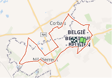
Trail On foot of 10.1 km to be discovered at Wallonia, Walloon Brabant, Walhain. This trail is proposed by madeleinediez.
Description
Départ à 09h30 de la place du Tram à 1357 Nil St Vincent (Entité de Walhain -ST Paul )
Positioning
Country:
Belgium
Region :
Wallonia
Department/Province :
Walloon Brabant
Municipality :
Walhain
Location:
Unknown
Start:(Dec)
Start:(UTM)
617873 ; 5610812 (31U) N.
Comments