


ITI0364

jeanic63
User

Length
7.5 km

Max alt
432 m

Uphill gradient
90 m
Km-Effort
8.7 km

Min alt
367 m

Downhill gradient
90 m
Boucle
Yes
Creation date :
2019-12-29 10:28:04.873
Updated on :
2020-01-08 09:00:09.933
--
Difficulty : Very easy

FREE GPS app for hiking
 SityTrail
IGN / Geographical institutes
SityTrail Plus
The world is yours!
About
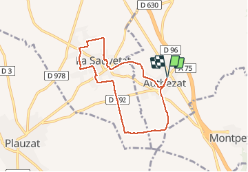
Trail On foot of 7.5 km to be discovered at Auvergne-Rhône-Alpes, Puy-de-Dôme, Authezat. This trail is proposed by jeanic63.
Description
départ Authezat place de la bascule
Positioning
Country:
France
Region :
Auvergne-Rhône-Alpes
Department/Province :
Puy-de-Dôme
Municipality :
Authezat
Location:
Unknown
Start:(Dec)
Start:(UTM)
514494 ; 5053298 (31T) N.
Comments