


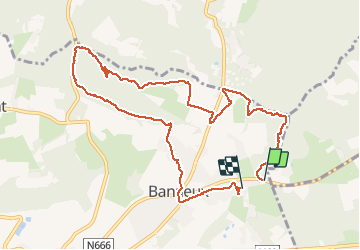
banneux

patrick357
User

Length
10.6 km

Max alt
315 m

Uphill gradient
213 m
Km-Effort
13.5 km

Min alt
174 m

Downhill gradient
220 m
Boucle
No
Creation date :
2019-12-29 12:44:44.142
Updated on :
2019-12-29 17:54:39.283
4h10
Difficulty : Very easy

FREE GPS app for hiking
 SityTrail
IGN / Geographical institutes
SityTrail Plus
The world is yours!
About
Trail Walking of 10.6 km to be discovered at Wallonia, Liège, Sprimont. This trail is proposed by patrick357.
Positioning
Country:
Belgium
Region :
Wallonia
Department/Province :
Liège
Municipality :
Sprimont
Location:
Louveigné
Start:(Dec)
Start:(UTM)
694937 ; 5602241 (31U) N.
Comments