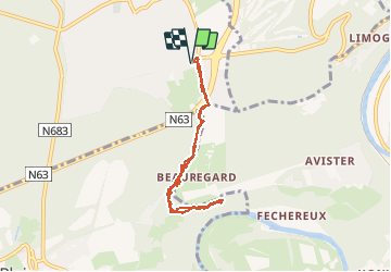
De Boncelles à Roche aux faucons

henriantoine
User


3h02
Difficulty : Medium

FREE GPS app for hiking
 SityTrail
IGN / Geographical institutes
SityTrail Plus
The world is yours!
About
Trail Walking of 6.1 km to be discovered at Wallonia, Liège, Seraing. This trail is proposed by henriantoine.
Description
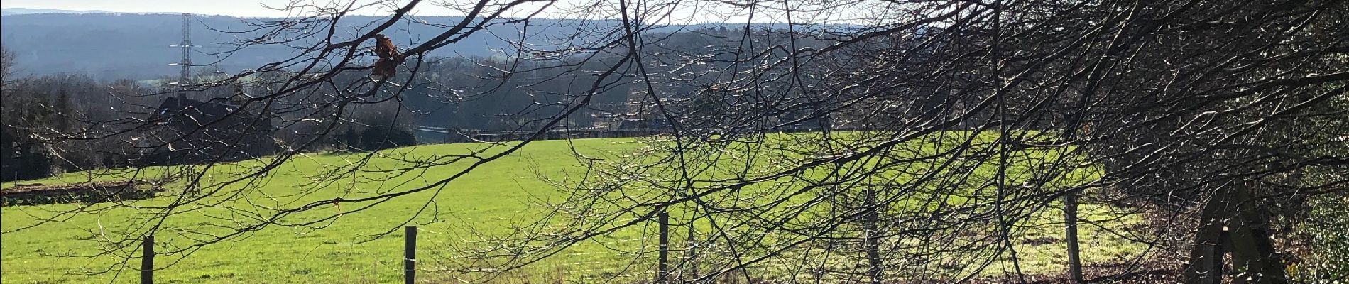
Sans aucun doute belle découverte, du point de vue des boucles de l’Ourthe depuis la roche aux faucons.
Les marcheurs venant d’ailleurs peuvent se garer confortablement au parking du Brico - Carrefour a Boncelles et partir à pied direction de la pompe Esso route du Condroz ... après une descente par les bois :
La Roche-aux-faucons ... un lieu-dit et point de vue sis dans de la commune d’Esneux. La découverte est extraordinaire depuis à droite la tour de Berinzenne (Spa) distante de 30 km au chateau d’eau de xhoris ect ...
Photos


Positioning
Comments