


col de l'Ovine et Croix du Puvat

sebastienu
User
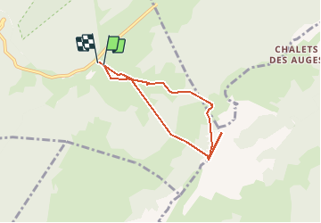

Length
6 km

Max alt
1880 m

Uphill gradient
518 m
Km-Effort
12.9 km

Min alt
1397 m

Downhill gradient
500 m
Boucle
Yes
Creation date :
2019-12-31 07:51:43.962
Updated on :
2019-12-31 11:49:10.159
3h56
Difficulty : Difficult

FREE GPS app for hiking
 SityTrail
IGN / Geographical institutes
SityTrail Plus
The world is yours!
About
Trail Snowshoes of 6 km to be discovered at Auvergne-Rhône-Alpes, Upper Savoy, Fillière. This trail is proposed by sebastienu.
Description
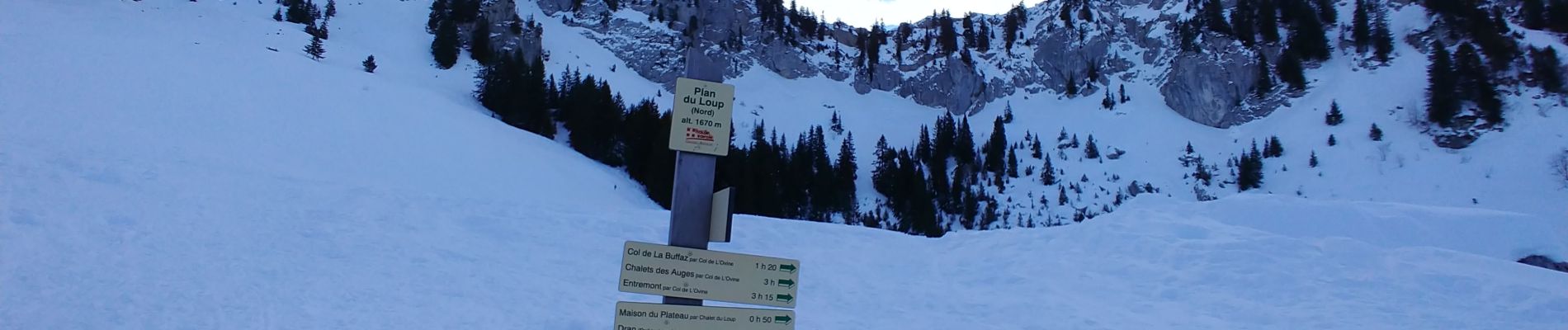
Départ du plateau des Glières, retour en coupant
Photos


Positioning
Country:
France
Region :
Auvergne-Rhône-Alpes
Department/Province :
Upper Savoy
Municipality :
Fillière
Location:
Thorens-Glières
Start:(Dec)
Start:(UTM)
292491 ; 5092929 (32T) N.
Comments