Trail Walking Vauvenargues - Montagne Sainte   Victoire - Photo
 franquen
franquen

User

© OpenStreetMap contributors
Length
Length
10.8 km
Max alt
Max alt
909 m
Uphill gradient
Uphill gradient
594 m
Km-Effort
Km-Effort  
18.6 km
Min alt
Min alt
348 m
Downhill gradient
Downhill gradient
573 m
Boucle
Boucle
Yes
Creation date :
2020-01-01 09:13:11.113
Updated on :
2020-01-04 20:49:48.594

(0 Reviews)

Walking
Walking
4h43
Difficulty : Medium

Scan this QR Code to open this trail in the SityTrail application

FREE GPS app for hiking

Logo SityTrail SityTrail

IGN / Geographical institutes

Download SityTrail from the App Store Download SityTrail from Google Play

Logo SityTrail SityTrail Plus

The world is yours!

Download SityTrail from the App Store Download SityTrail from Google Play Download SityTrail on Huawei AppGallery

About

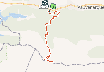
Trail Walking of 10.8 km to be discovered at Provence-Alpes-Côte d'Azur, Bouches-du-Rhône, Vauvenargues. This trail is proposed by franquen.

Description

départ de Vauvenargues avec une montée raide sur un chemin large et bien damé  puis sentier de rando normal pour les derniers 100m.
Superbe vue par beau temps.
montée et descente en hubac donc un peu glissant en hiver, prendre les batons

Elevation profile

Positioning

Country:
France
Region :
Provence-Alpes-Côte d'Azur
Department/Province :
Bouches-du-Rhône
Municipality :
Vauvenargues
Location:
Unknown
Start:(UTM)
708313 ; 4825398 (31T) N.


Close
My subscriptions