


Loudanvielle jour 4

dudu85
User

Length
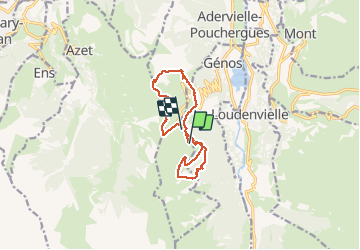
12.5 km

Max alt
1746 m

Uphill gradient
620 m
Km-Effort
21 km

Min alt
1339 m

Downhill gradient
639 m
Boucle
No
Creation date :
2020-01-01 10:03:44.0
Updated on :
2020-01-01 16:03:20.597
5h43
Difficulty : Unknown

FREE GPS app for hiking
 SityTrail
IGN / Geographical institutes
SityTrail Plus
The world is yours!
About
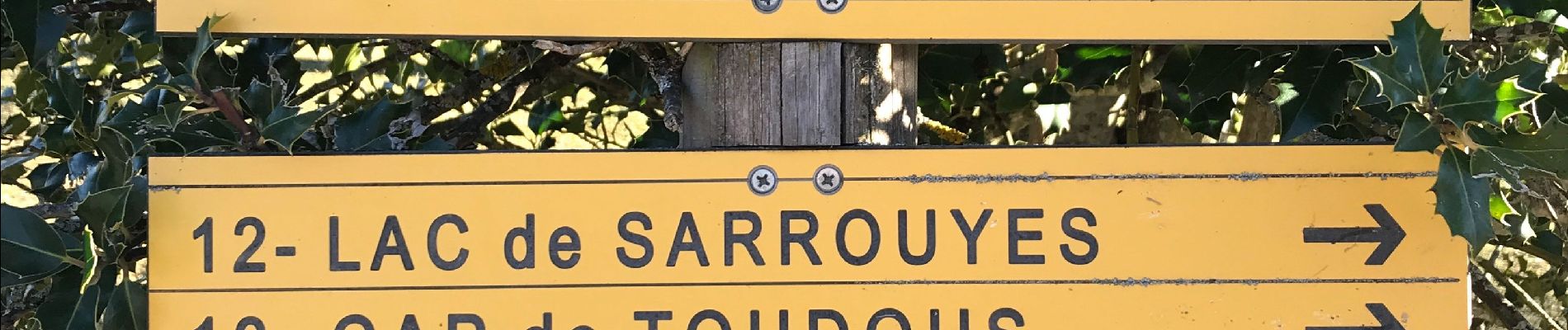
Trail Walking of 12.5 km to be discovered at Occitania, Hautespyrenees, Adervielle-Pouchergues. This trail is proposed by dudu85.
Photos


Positioning
Country:
France
Region :
Occitania
Department/Province :
Hautespyrenees
Municipality :
Adervielle-Pouchergues
Location:
Unknown
Start:(Dec)
Start:(UTM)
286566 ; 4740602 (31T) N.
Comments