Trail On foot Billère - 2020-01-04_18h53m53_Cirkwi-Billère_-_Les_Rives_du_Gave - Photo

2020-01-04_18h53m53_Cirkwi-Billère_-_Les_Rives_du_Gave

 marmotte65
marmotte65

User GUIDE

© OpenStreetMap contributors
Length
Length
5.6 km
Max alt
Max alt
201 m
Uphill gradient
Uphill gradient
52 m
Km-Effort
Km-Effort  
6.3 km
Min alt
Min alt
163 m
Downhill gradient
Downhill gradient
52 m
Boucle
Boucle
Yes
Creation date :
2020-01-04 17:53:53.404
Updated on :
2022-09-26 13:39:52.817

(0 Reviews)

On foot
On foot
--
Difficulty : Very easy

Scan this QR Code to open this trail in the SityTrail application

FREE GPS app for hiking

Logo SityTrail SityTrail

IGN / Geographical institutes

Download SityTrail from the App Store Download SityTrail from Google Play

Logo SityTrail SityTrail World

The world is yours!

Download SityTrail from the App Store Download SityTrail from Google Play Download SityTrail on Huawei AppGallery

About

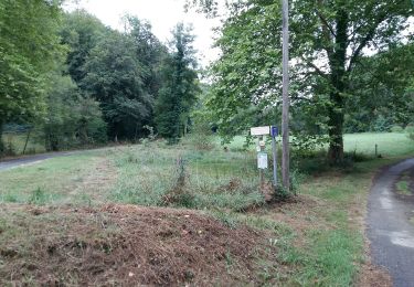
Trail On foot of 5.6 km to be discovered at New Aquitaine, Pyrénées-Atlantiques, Billère. This trail is proposed by marmotte65.

Description

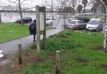
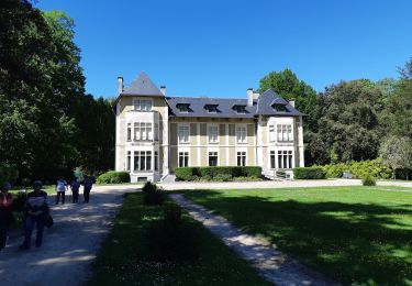
Les Berges du gave à Billère constituent un superbe espace au bord de l’eau, aménagé pour la détente et le sport. C’est aussi le départ de cette boucle qui nous fait suivre les rives du gave au plus près et parcourir des paysages emblématiques de Pau.  Départ : Parking - Berges du Gave - Rue de la Gravière - Billère Aucun Balisage

Elevation profile

Positioning

Country:
France
Region :
New Aquitaine
Department/Province :
Pyrénées-Atlantiques
Municipality :
Billère
Location:
Unknown
Start:(UTM)
710587 ; 4796754 (30T) N.

Trails nearby

Trail Walking Pau - Pau bois de bastard - Photo
Walking
GUIDE
marmotte65

Walking

Very easy
(1)
Pau, New Aquitaine, Pyrénées-Atlantiques, France
5 km | 5.5 km-effort
1h 54min
Yes
Trail On foot Lescar - Lescar du 2018-06-24 - Photo
On foot
GUIDE
marmotte65

On foot

Very easy
(1)
Lescar, New Aquitaine, Pyrénées-Atlantiques, France
7.6 km | 8.6 km-effort
Unknown
Yes
Trail Walking Laroin - Les vignes en terrasses des collines de Jurançon - Photo
Walking
tracegps

Walking

Difficult
(3)
Laroin, New Aquitaine, Pyrénées-Atlantiques, France
19.6 km | 27 km-effort
5h 0min
Yes
Trail Walking Pau - PAU RS entre jardins et villa quartier Trespoey
Walking
GUIDE
marmotte65

Walking

Medium
Pau, New Aquitaine, Pyrénées-Atlantiques, France
5.5 km | 6.2 km-effort
1h 24min
Yes
Trail Walking Bizanos - BIZANOS RANDONNÉE PATRIMOINE   2868740 - Photo
Walking
GUIDE
marmotte65

Walking

Easy
Bizanos, New Aquitaine, Pyrénées-Atlantiques, France
7.6 km | 8.6 km-effort
1h 52min
No
Trail Walking Uzos - UZOS la boucle de la glandee  balisee le 29 07 20 - Photo
Walking
GUIDE
marmotte65

Walking

Medium
Uzos, New Aquitaine, Pyrénées-Atlantiques, France
13.1 km | 17.3 km-effort
8h 14min
Yes
Trail On foot Bizanos - OT les hauteurs de Franqueville-fait - Photo
On foot
GUIDE
marmotte65

On foot

Very easy
(1)
Bizanos, New Aquitaine, Pyrénées-Atlantiques, France
3.6 km | 4.5 km-effort
Unknown
Yes
Trail Mountain bike Gelos - Bizanos - Rando VTT Boucle Nousty - Stade d'eau vive de Pau - 32 Km - Photo
Mountain bike
potofe

Mountain bike

Medium
(1)
Gelos, New Aquitaine, Pyrénées-Atlantiques, France
32 km | 38 km-effort
2h 32min
Yes
Trail On foot Pau - PAU terra aventura
On foot
GUIDE
marmotte65

On foot

Easy
Pau, New Aquitaine, Pyrénées-Atlantiques, France
4.2 km | 5.2 km-effort
1h 10min
No


Close
My subscriptions