


Val de Morge

jeanic63
User

Length
7.9 km

Max alt
317 m

Uphill gradient
62 m
Km-Effort
8.7 km

Min alt
297 m

Downhill gradient
62 m
Boucle
Yes
Creation date :
2020-01-05 16:41:01.568
Updated on :
2020-01-08 09:16:00.411
--
Difficulty : Very easy

FREE GPS app for hiking
 SityTrail
IGN / Geographical institutes
SityTrail Plus
The world is yours!
About
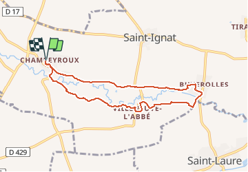
Trail On foot of 7.9 km to be discovered at Auvergne-Rhône-Alpes, Puy-de-Dôme, Saint-Ignat. This trail is proposed by jeanic63.
Description
départ Champéroux place Darrenne
Positioning
Country:
France
Region :
Auvergne-Rhône-Alpes
Department/Province :
Puy-de-Dôme
Municipality :
Saint-Ignat
Location:
Unknown
Start:(Dec)
Start:(UTM)
519260 ; 5085084 (31T) N.
Comments