


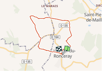
St Cyr du Ronceray

Eve - Line
User

Length
6.9 km

Max alt
171 m

Uphill gradient
47 m
Km-Effort
7.5 km

Min alt
133 m

Downhill gradient
47 m
Boucle
Yes
Creation date :
2020-01-08 12:08:48.181
Updated on :
2020-01-08 13:51:50.771
1h42
Difficulty : Very easy

FREE GPS app for hiking
 SityTrail
IGN / Geographical institutes
SityTrail Plus
The world is yours!
About
Trail Walking of 6.9 km to be discovered at Normandy, Calvados, Valorbiquet. This trail is proposed by Eve - Line.
Positioning
Country:
France
Region :
Normandy
Department/Province :
Calvados
Municipality :
Valorbiquet
Location:
Saint-Cyr-du-Ronceray
Start:(Dec)
Start:(UTM)
302651 ; 5436900 (31U) N.
Comments