


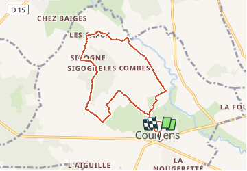
La balade de COULGENS

alainjoseph6
User

Length
8.1 km

Max alt
105 m

Uphill gradient
101 m
Km-Effort
9.4 km

Min alt
66 m

Downhill gradient
101 m
Boucle
Yes
Creation date :
2020-01-09 12:49:00.165
Updated on :
2020-01-09 15:11:47.679
2h21
Difficulty : Very easy

FREE GPS app for hiking
 SityTrail
IGN / Geographical institutes
SityTrail Plus
The world is yours!
About
Trail Walking of 8.1 km to be discovered at New Aquitaine, Charente, Coulgens. This trail is proposed by alainjoseph6.
Description
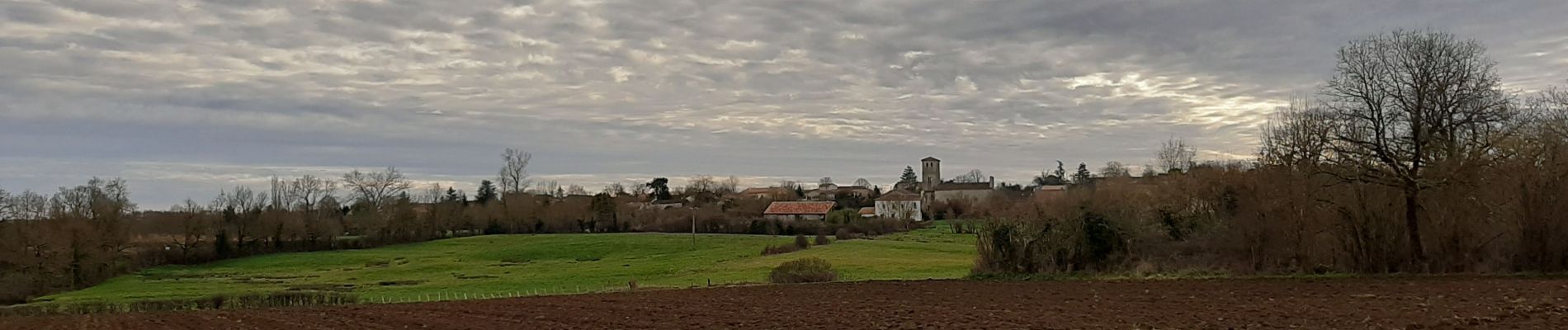
une belle balade qui permet de découvrir la vallée de la Tardoire.
Photos


Positioning
Country:
France
Region :
New Aquitaine
Department/Province :
Charente
Municipality :
Coulgens
Location:
Unknown
Start:(Dec)
Start:(UTM)
289142 ; 5076556 (31T) N.
Comments