


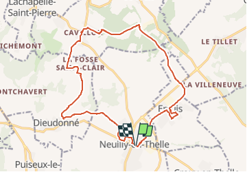
Neuilly en Thelle, ERcuis, Cavillon et Dieudonné

philberard95
User

Length
17.8 km

Max alt
185 m

Uphill gradient
227 m
Km-Effort
21 km

Min alt
85 m

Downhill gradient
228 m
Boucle
Yes
Creation date :
2020-01-10 08:42:23.921
Updated on :
2023-01-11 11:06:15.383
4h33
Difficulty : Very difficult

FREE GPS app for hiking
 SityTrail
IGN / Geographical institutes
SityTrail Plus
The world is yours!
About
Trail Walking of 17.8 km to be discovered at Hauts-de-France, Oise, Neuilly-en-Thelle. This trail is proposed by philberard95.
Positioning
Country:
France
Region :
Hauts-de-France
Department/Province :
Oise
Municipality :
Neuilly-en-Thelle
Location:
Unknown
Start:(Dec)
Start:(UTM)
448073 ; 5452577 (31U) N.
Comments