


mont Rond ND de Bellecombe

ranchoup
User
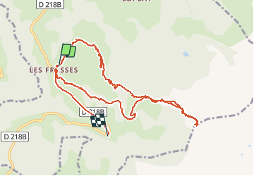

Length
12.9 km

Max alt
1958 m

Uphill gradient
603 m
Km-Effort
21 km

Min alt
1425 m

Downhill gradient
647 m
Boucle
No
Creation date :
2020-01-09 08:59:42.525
Updated on :
2020-01-10 10:50:57.109
5h10
Difficulty : Easy

FREE GPS app for hiking
 SityTrail
IGN / Geographical institutes
SityTrail Plus
The world is yours!
About
Trail Walking of 12.9 km to be discovered at Auvergne-Rhône-Alpes, Savoy, Notre-Dame-de-Bellecombe. This trail is proposed by ranchoup.
Description
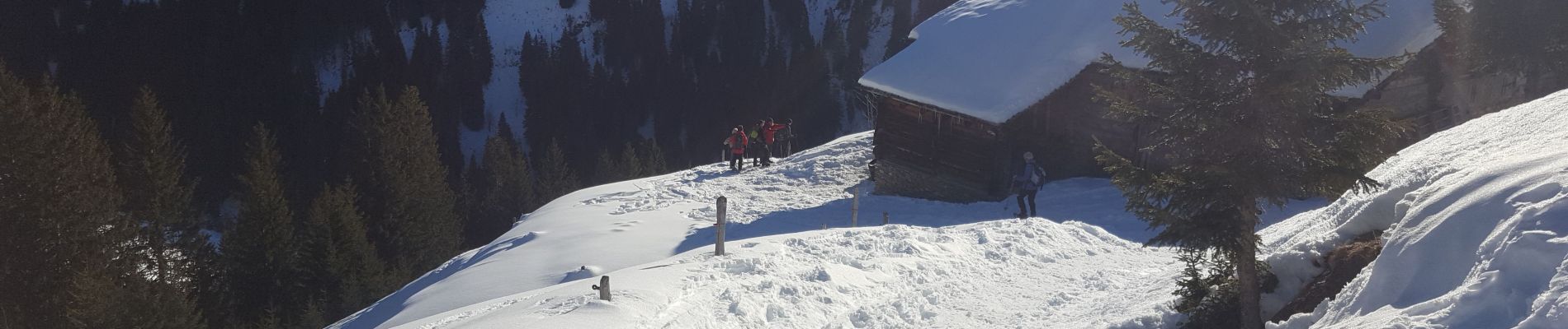
rando a raqettes a neige
Photos


Positioning
Country:
France
Region :
Auvergne-Rhône-Alpes
Department/Province :
Savoy
Municipality :
Notre-Dame-de-Bellecombe
Location:
Unknown
Start:(Dec)
Start:(UTM)
309386 ; 5073607 (32T) N.
Comments