


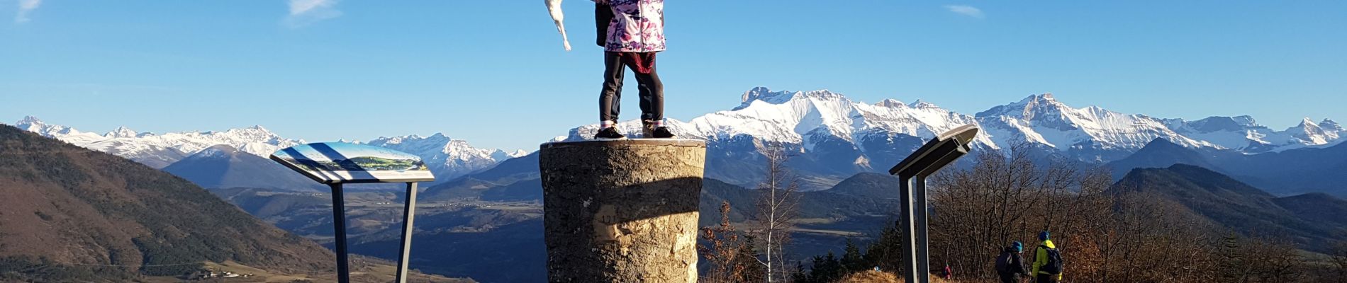
Côte rouge - table d'orientation

crocau
User
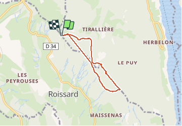

Length
5.3 km

Max alt
1040 m

Uphill gradient
257 m
Km-Effort
8.8 km

Min alt
893 m

Downhill gradient
258 m
Boucle
Yes
Creation date :
2020-01-12 13:58:19.105
Updated on :
2020-02-24 12:57:54.595
1h42
Difficulty : Very easy

FREE GPS app for hiking
 SityTrail
IGN / Geographical institutes
SityTrail Plus
The world is yours!
About
Trail Walking of 5.3 km to be discovered at Auvergne-Rhône-Alpes, Isère, Treffort. This trail is proposed by crocau.
Photos


Positioning
Country:
France
Region :
Auvergne-Rhône-Alpes
Department/Province :
Isère
Municipality :
Treffort
Location:
Unknown
Start:(Dec)
Start:(UTM)
708393 ; 4974926 (31T) N.
Comments
Des pistes qui mènent à un très joli point de vue. A faire de préférence en vélo