


U 2020 21.01 La Rochepot

clabidault
User
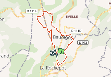

Length
7 km

Max alt
556 m

Uphill gradient
244 m
Km-Effort
10.2 km

Min alt
386 m

Downhill gradient
245 m
Boucle
Yes
Creation date :
2020-01-15 12:49:17.457
Updated on :
2020-01-15 17:43:32.974
2h46
Difficulty : Very easy

FREE GPS app for hiking
 SityTrail
IGN / Geographical institutes
SityTrail Plus
The world is yours!
About
Trail Walking of 7 km to be discovered at Bourgogne-Franche-Comté, Côte-d'Or, La Rochepot. This trail is proposed by clabidault.
Positioning
Country:
France
Region :
Bourgogne-Franche-Comté
Department/Province :
Côte-d'Or
Municipality :
La Rochepot
Location:
Unknown
Start:(Dec)
Start:(UTM)
627843 ; 5202252 (31T) N.
Comments
ballade plaisante et bien vallonnée