


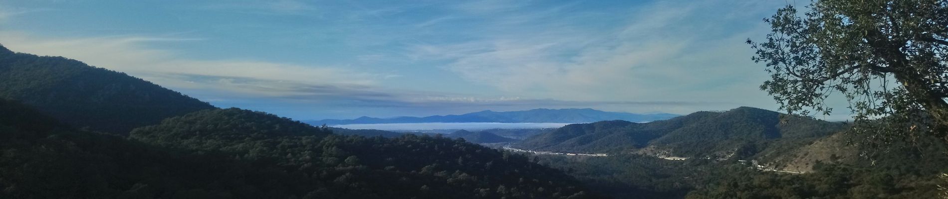
malpasset, l'Avellan

Michel DUBOIS
User
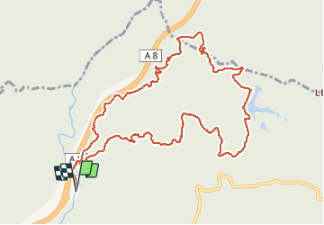

Length
12.4 km

Max alt
288 m

Uphill gradient
387 m
Km-Effort
17.6 km

Min alt
36 m

Downhill gradient
386 m
Boucle
Yes
Creation date :
2020-01-16 07:26:01.974
Updated on :
2020-01-16 10:20:26.96
2h48
Difficulty : Very easy

FREE GPS app for hiking
 SityTrail
IGN / Geographical institutes
SityTrail Plus
The world is yours!
About
Trail Walking of 12.4 km to be discovered at Provence-Alpes-Côte d'Azur, Var, Fréjus. This trail is proposed by Michel DUBOIS.
Photos


Positioning
Country:
France
Region :
Provence-Alpes-Côte d'Azur
Department/Province :
Var
Municipality :
Fréjus
Location:
Unknown
Start:(Dec)
Start:(UTM)
318772 ; 4818871 (32T) N.
Comments