


Hottot les Bagues 9 kms 2020

aubinjoel
User
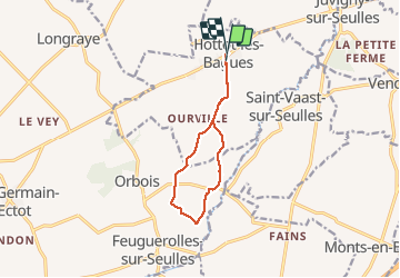

Length
8.9 km

Max alt
124 m

Uphill gradient
151 m
Km-Effort
11 km

Min alt
71 m

Downhill gradient
149 m
Boucle
Yes
Creation date :
2020-01-16 15:01:49.258
Updated on :
2020-01-16 15:03:29.105

FREE GPS app for hiking
 SityTrail
IGN / Geographical institutes
SityTrail Plus
The world is yours!
About
Trail of 8.9 km to be discovered at Normandy, Calvados, Hottot-les-Bagues. This trail is proposed by aubinjoel.
Positioning
Country:
France
Region :
Normandy
Department/Province :
Calvados
Municipality :
Hottot-les-Bagues
Location:
Unknown
Start:(Dec)
Start:(UTM)
671351 ; 5446980 (30U) N.
Comments