


Autignac-Lenthéric-Autignac / Course à pied et vélo

PiloudeBamako
User
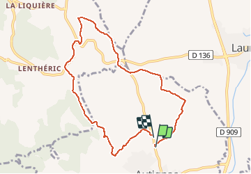

Length
9.1 km

Max alt
204 m

Uphill gradient
161 m
Km-Effort
11.3 km

Min alt
124 m

Downhill gradient
169 m
Boucle
Yes
Creation date :
2020-01-19 11:37:36.0
Updated on :
2020-01-25 21:16:50.328
--
Difficulty : Difficult

FREE GPS app for hiking
 SityTrail
IGN / Geographical institutes
SityTrail Plus
The world is yours!
About
Trail Running of 9.1 km to be discovered at Occitania, Hérault, Autignac. This trail is proposed by PiloudeBamako.
Description
Boucle d'une dizaine de kilomètres au nord d'Autignac pour course à, pied accompagnée d'un vélo
Positioning
Country:
France
Region :
Occitania
Department/Province :
Hérault
Municipality :
Autignac
Location:
Unknown
Start:(Dec)
Start:(UTM)
513867 ; 4816869 (31T) N.
Comments