


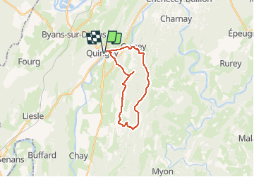
Quingey Montfort 21 janv 2020 CAF

TRIMAILLE
User

Length
20 km

Max alt
545 m

Uphill gradient
534 m
Km-Effort
27 km

Min alt
260 m

Downhill gradient
535 m
Boucle
Yes
Creation date :
2020-01-21 08:10:32.702
Updated on :
2020-01-21 16:38:33.166
5h52
Difficulty : Difficult

FREE GPS app for hiking
 SityTrail
IGN / Geographical institutes
SityTrail Plus
The world is yours!
About
Trail Walking of 20 km to be discovered at Bourgogne-Franche-Comté, Doubs, Quingey. This trail is proposed by TRIMAILLE.
Description
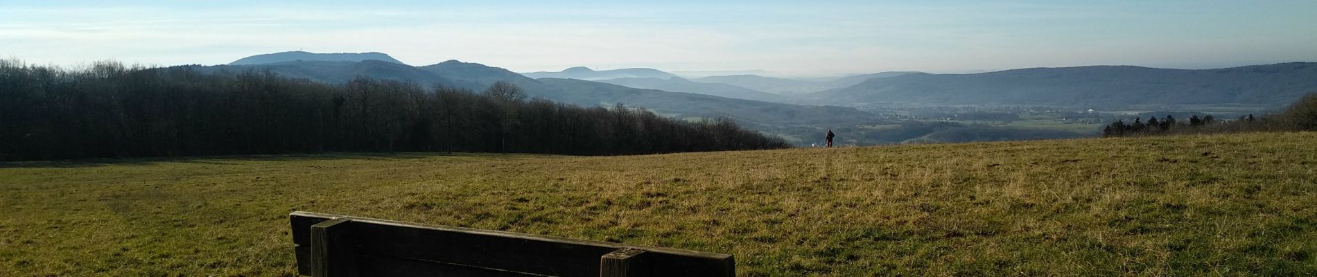
Départ du camping de Quingey au bord de la Loue. Passage à Montfort.
Photos

Positioning
Country:
France
Region :
Bourgogne-Franche-Comté
Department/Province :
Doubs
Municipality :
Quingey
Location:
Unknown
Start:(Dec)
Start:(UTM)
718966 ; 5220695 (31T) N.
Comments