


Le pas du touet

raygautier
User

Length
32 km

Max alt
1299 m

Uphill gradient
241 m
Km-Effort
39 km

Min alt
111 m

Downhill gradient
1293 m
Boucle
No
Creation date :
2020-01-22 12:43:44.0
Updated on :
2020-01-23 07:28:22.991
13h00
Difficulty : Unknown

FREE GPS app for hiking
 SityTrail
IGN / Geographical institutes
SityTrail Plus
The world is yours!
About
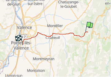
Trail Walking of 32 km to be discovered at Auvergne-Rhône-Alpes, Drôme, Léoncel. This trail is proposed by raygautier.
Positioning
Country:
France
Region :
Auvergne-Rhône-Alpes
Department/Province :
Drôme
Municipality :
Léoncel
Location:
Unknown
Start:(Dec)
Start:(UTM)
670815 ; 4976144 (31T) N.
Comments